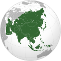
Iyeltak:Asia (orthographic projection).svg

Xantaf iyeltak (SVG iyeltak, prekson 541 × 541 pixels, iyeltakaldo : 557 kio)
Bat iyeltak tir mal Wikimedia Commons ise gan yonar abdumimaks rotir zo faver. Pimtara moe inafu iyeltakbu valeveon zo nedir.
Pimtara
| PimtaraAsia (orthographic projection).svg |
العربية: الخريطة الهجائية لآسيا English: Asia |
||||
| Evla | |||||
| Klita |
National Geographic. Map by Ssolbergj
|
||||
| Askisik | Koyos + Ssolbergj | ||||
| Autres versions |
العربية: الرجاء، قراءة الميثاق.
বাংলা: দয়া করে, রীতিনীতিটি পড়ুন।
Deutsch: Bitte lies die Konventionen.
English: Please, read the conventions.
Español: Por favor, lea las convenciones.
Filipino: Paki-basa ang mga kumbensyon.
Français : S'il vous plaît, lisez les conventions.
हिन्दी: कृपया सभागमों को पढ़ लें.
Bahasa Indonesia: Silakan, baca konvensi.
Italiano: Si prega di leggere le convenzioni.
日本語: 規約をご確認ください。
ქართული: გთხოვთ, გაეცნოთ კონვენციებს.
Македонски: Ве молиме, прочитајте ги општоприфатените правила.
Português: Por favor, leia as convenções.
Русский: Пожалуйста, прочитайте соглашения.
Tagalog: Paki-basa ang mga kumbensyon.
Українська: Будь ласка, прочитайте конвенції.
Tiếng Việt: Hãy đọc công văn trước khi đăng.
中文(繁體):請檢視公約
中文(简体):请查看公约
|
||||
| SVG information InfoField |
Sortara :

|
Permission is granted to copy, distribute and/or modify this document under the terms of the GNU Free Documentation License, Version 1.2 or any later version published by the Free Software Foundation; with no Invariant Sections, no Front-Cover Texts, and no Back-Cover Texts. A copy of the license is included in the section entitled GNU Free Documentation License.http://www.gnu.org/copyleft/fdl.htmlGFDLGNU Free Documentation Licensetruetrue |
- Til nuyaf :
- Ta walzilira – ta ksudara va kobara azu walzilira azu deara
- Ta warzafa ponara – Ta zalera va grabom
- Nope valevef kredeem :
- gaara – Va folack govanzilil ise va gluyaxa godaful ise gobazel kase betara al zo skud. Laninde gonaskil voxe mekane gometiavel da gelfasik va rin ik rinafa favera vanovar.
- Milinde paká – Ede va bat valdig betal ike artazukar ike voner, pune va nekis valdig wetce mila ok milafa sorta gu bat goxolel.
| Annotations InfoField | This image is annotated: View the annotations at Commons |
India
Sri Lanka
Russia
Mongolia
China
Africa
Oceania
South Korea
North America
Europe
North Korea
Japan
Pakistan
Saudi Arabia
Kazakhstan
Papua New Guinea
Indonesia
Nepal
Iran
Cyprus
Kamchatka
Hokkaido
Cambodia
Turkey
Afghanistan
Bhutan
Philippines
Malaysia
Thailand
Vietnam
Légendes
statut des droits d'auteur français
sous droit d'auteur français
licence français
Licence de documentation libre GNU français
date de fondation ou de création français
15 bareaksat 2009
type MIME français
image/svg+xml
somme de contrôle français
172f5e66318d09590c698956d4edb40320c8ce53
taille des données français
570 850 octet
hauteur français
541 pixel
largeur français
541 pixel
Iyeltakizvot
Witison va iyeltak inde in banugale awir, va evla/bartiv vulegal !!
| Evla/Bartiv | Aluk | Lumeem | Favesik | Sebuks | |
|---|---|---|---|---|---|
| ref | 29 pereaksat 2023 à 18:11 |  | 541 × 541 (557 kio) | Bennylin | synchronize with File:Southeast Asia (orthographic projection).svg. Source: File:United Nations geographical subregions.png |
| 18 bareaksat 2023 à 00:57 |  | 541 × 541 (496 kio) | Golden Mage | A change to the map of Asia will first face debate from others. Hence, a change to the commonly accepted map of Oceania cannot be made without a wider consensus. | |
| 17 bareaksat 2023 à 03:44 |  | 541 × 541 (557 kio) | Kwamikagami | the Weber line divides Asian from Oceanic Wallacea | |
| 4 lerdeaksat 2022 à 19:29 |  | 541 × 541 (496 kio) | Рагин1987 | Socotra repainted | |
| 4 lerdeaksat 2022 à 17:20 |  | 541 × 541 (492 kio) | Рагин1987 | Final edit | |
| 4 lerdeaksat 2022 à 12:43 |  | 541 × 541 (446 kio) | Рагин1987 | Correction | |
| 31 anyusteaksat 2022 à 13:13 |  | 2048 × 2048 (1,04 Mio) | Рагин1987 | Small correction (Socotra Island is geologically closer to Africa) | |
| 13 santoleaksat 2019 à 17:59 |  | 541 × 541 (242 kio) | Goran tek-en | Added border for South Sudan as requested by {{u|Maphobbyist}} | |
| 13 toleaksat 2019 à 10:16 |  | 541 × 541 (161 kio) | عبد الله | Reverted to version as of 16:47, 19 September 2016 (UTC) | |
| 13 toleaksat 2019 à 10:11 |  | 512 × 512 (120 kio) | عبد الله | إزاة خطوط زعجة |
Favera va iyeltak
Valevefa bugluyaxa va bat iyeltak :
Jadifa iyeltakura
Valevefi wiki va bat iyeltak malsaved :
- Favera dene ab.wikipedia.org
- Favera dene ace.wikipedia.org
- Favera dene ady.wikipedia.org
- Favera dene af.wikipedia.org
- Afrika
- Asië
- Europa
- Filippyne
- Irak
- Israel
- Japan
- Noord-Amerika
- Suid-Amerika
- Volksrepubliek China
- Thailand
- Singapoer
- Maleisië
- Afghanistan
- Sjabloon:Kontinente
- Bangkok
- Katar
- Taipei
- Indië
- Rusland
- Oesbekistan
- Hoofstad
- Lys van hoofstede
- Siprus
- Armenië
- Sjabloon:Lande van Asië
- Iran
- Egipte
- Wikipedia:Sjabloon
- Turkmenistan
- Wikipedia:Lys van sjablone
- Britse Indiese Oseaangebied
- Suid-Korea
- Noord-Korea
- Antarktika
- Beijing
- Gondwana
- Eurasië
- Laurasië
- Kategorie:Lande in Asië
- Libanon
- Jerusalem
- Azerbeidjan
- Bahrein
loa favera va bat iyeltak wil !!
Veyorigeem
Bat iyeltak va loplekufa giva ruldar. Bata giva male reduso ok tuotukaso wanuyasiko iku ksudasiko lanon zo loplekuyur. Ede iyeltak malion di zo betayar, konaka pinta va betayana ewava rotir me co tcazecked.
| Mantuca | 541.48 |
|---|---|
| Ontinuca | 541.48 |


