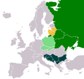
Iyeltak:Balto Slavic countries.png

Balto_Slavic_countries.png(450 × 422 pixel, iyeltakaldo : 14 kio, MIME ord : image/png)

Bat iyeltak tir mal Wikimedia Commons ise gan yonar abdumimaks rotir zo faver. Pimtara moe inafu iyeltakbu valeveon zo nedir.

Atlas This map has been uploaded by Electionworld from en.wikipedia.org to enable the Wikimedia Atlas of the World . Original uploader to en.wikipedia.org was PANONIAN, known as PANONIAN at en.wikipedia.org. Electionworld is not the creator of this map. Licensing information is below.

Created from this image: http://en.wikipedia.org/wiki/Image:Slavic_europe.png Thus, same tag as there.

Une version vectorielle de cette image existe, dans le format « SVG ». Elle devrait être utilisée à la place de cette image matricielle.

File:Balto Slavic countries.png → File:Balto Slavic countries.svg

Pour plus d’informations sur les images vectorielles, consultez la page de transition de Commons vers le format SVG.
Voir aussi les informations à propos de la manière dont le logiciel MediaWiki gère les images au format SVG.

Dans les autres langues
Alemannisch  Bahasa Indonesia  Bahasa Melayu  British English  català  čeština  dansk  Deutsch  eesti  English  español  Esperanto  euskara  français  Frysk  galego  hrvatski  Ido  italiano  lietuvių  magyar  Nederlands  norsk bokmål  norsk nynorsk  occitan  Plattdüütsch  polski  português  português do Brasil  română  Scots  sicilianu  slovenčina  slovenščina  suomi  svenska  Tiếng Việt  Türkçe  vèneto  Ελληνικά  беларуская (тарашкевіца)  български  македонски  нохчийн  русский  српски / srpski  татарча/tatarça  українська  ქართული  հայերեն  বাংলা  தமிழ்  മലയാളം  ไทย  한국어  日本語  简体中文  繁體中文  עברית  العربية  فارسی  +/−
Nouvelle image SVG


GNU head Permission is granted to copy, distribute and/or modify this document under the terms of the GNU Free Documentation License, Version 1.2 or any later version published by the Free Software Foundation; with no Invariant Sections, no Front-Cover Texts, and no Back-Cover Texts. A copy of the license is included in the section entitled GNU Free Documentation License.
w:fr:Creative Commons
gaara Milinde paká
Bat iyeltak wetce Creative Commons Attribution-Share Alike 3.0 Unported zo sortayar.
Til nuyaf :
  • Ta walzilira – ta ksudara va kobara azu walzilira azu deara
  • Ta warzafa ponara – Ta zalera va grabom
Nope valevef kredeem :
  • gaara – Va folack govanzilil ise va gluyaxa godaful ise gobazel kase betara al zo skud. Laninde gonaskil voxe mekane gometiavel da gelfasik va rin ik rinafa favera vanovar.
  • Milinde paká – Ede va bat valdig betal ike artazukar ike voner, pune va nekis valdig wetce mila ok milafa sorta gu bat goxolel.
Ce bandeau de licence a été ajouté à ce fichier dans le cadre de la procédure de mise à jour des licences des images sous GFDL.

Légendes

Ajoutez en une ligne la description de ce que représente ce fichier

Éléments décrits dans ce fichier

dépeint français

type MIME français

image/png

3dbf1e6408e1a4505b69d8a8ea3f1272490e5c2d

méthode de détermination français : SHA-1 français

14 311 octet

hauteur français

422 pixel

largeur français

450 pixel

Iyeltakizvot

Witison va iyeltak inde in banugale awir, va evla/bartiv vulegal !!

Evla/BartivAlukLumeemFavesikSebuks
ref3 santoleaksat 2006 à 15:23Aluk va siatos ke 3 santoleaksat 2006 à 15:23450 × 422 (14 kio)Electionworld{{ew|en|PANONIAN}} Created from this image: http://en.wikipedia.org/wiki/Image:Slavic_europe.png Thus, same tag as there. {{GFDL}} Category:Maps of Europe Category:Ethnic maps