Iyeltak:Brazil (orthographic projection).svg

Taille de cet aperçu PNG pour ce fichier SVG : 541 × 541 px. Ar goraks: 240 × 240 px | 480 × 480 px | 768 × 768 px | 1024 × 1024 px | 2048 × 2048 px.
Xantaf iyeltak (SVG iyeltak, prekson 541 × 541 pixels, iyeltakaldo : 88 kio)
Pimtara
| Pimtara |
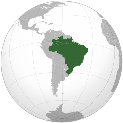
English: Brazil Português: Brasil Русский: Бразилия |
||||
| Evla | |||||
| Klita |
Travail personnel avec: Aquarius.geomar.de
|
||||
| Askisik | Ssolbergj | ||||
| Autres versions | Œuvres dérivées de ce fichier : LocationBrazil (orthographic).svg | ||||
| SVG information |

Mapas na Projeção Cartográfiaca. Mapas en Proyección cartográfica. Orthographic projection maps.
.svg)
.svg)
.svg)
.svg)
.svg)
.svg)
.svg)
.svg)
.svg)
.svg)
.svg)
.svg)
.svg)
.svg)
.svg)
.svg)
.svg)
.svg)
.svg)
.svg)
.svg)
.svg)
.svg)
.svg)
.svg)
.svg)
.svg)
.svg)
.svg)
.svg)
.svg)
.svg)
.svg)
.svg)
.svg)
.svg)
.svg)
.svg)
.svg)
.svg)
.svg)
.svg)
.svg)
.svg)
.svg)
.svg)
.svg)
.svg)
.svg)
.svg)
.svg)
.svg)
.svg)
.svg)
.svg)
.svg)
.svg)
.svg)
.svg)
.svg)
.svg)
.svg)
.svg)
.svg)
.svg)
.svg)
.svg)
.svg)
.svg)
.svg)
.svg)
.svg)
.svg)
.svg)

.svg)

.svg)

.svg)
.svg)
.svg)
.svg)
.svg)
.svg)
.svg)


.svg)
.svg)
.svg)
.svg)
.svg)
.svg)
.svg)

.svg)
.svg)
.svg)
.svg)
.svg)
.svg)
.svg)
.svg)
.svg)

.svg)
.svg)
.svg)
.svg)
.svg)
.svg)
.svg)
_without_national_boundaries.svg)
.svg)
.svg)
.svg)
.svg)
.svg)
.svg)

.svg)
.svg)
.png)
.svg)
.svg)
.svg)
.svg)

.svg)
.svg)
.svg)
.svg)
.svg)
.svg)
.svg)
.svg)
.svg)
.svg)
.svg)

.svg)
.svg)
.svg)
.svg)
.svg)
.svg)
.svg)
.svg)
.svg)

.svg)
.svg)

.svg)
.svg)
.svg)
.svg)
.svg)
.svg)
.svg)
.svg)
.svg)
.svg)
.svg)
.svg)
.svg)
.svg)
.svg)
.svg)
.svg)
.svg)
.svg)
.svg)
.svg)
.svg)
.svg)
.svg)
.svg)
.svg)
.svg)
_-_Crimea_disputed.svg)
.svg)
.svg)
.svg)
.svg)
.svg)
.svg)
.svg)
.svg)
.svg)
.svg)
.svg)
_political.svg)
.svg)
.svg)
.svg)
.svg)
_-_Crimea_disputed_-_no_borders.svg)
.svg)
.svg)
.svg)
.svg)
.svg)
.svg)
.svg)
.svg)
.svg)
.svg)
.svg)

.svg)
.svg)
.svg)

.png)
.svg)
.svg)
.svg)
.svg)
.svg)
.svg)
.svg)
.svg)
.svg)
.svg)
.svg)
.svg)
.svg)
.svg)
.svg)
.svg)
.svg)
.svg)
.svg)
.svg)
.svg)
.svg)
.svg)
.svg)
.svg)
.svg)
.svg)
.svg)
.svg)
.svg)
.svg)
.svg)
.svg)
.svg)
.png)
.svg)
.svg)
.svg)
_(orthographic_projection).png)
.svg)
.svg)
| Orthographic projections maps created by Ssolbergj |
|---|
| Orthographic projections maps created by Ssolbergj: |
.svg)
Sortara :
Moi, en tant que détenteur des droits d’auteur sur cette œuvre, je la publie sous la licence suivante :
Ce fichier est disponible selon les termes de la licence Creative Commons Attribution 3.0 Non transposée.
- Til nuyaf :
- Ta walzilira – ta ksudara va kobara azu walzilira azu deara
- Ta warzafa ponara – Ta zalera va grabom
- Nope valevef kredeem :
- gaara – Va folack govanzilil ise va gluyaxa godaful ise gobazel kase betara al zo skud. Laninde gonaskil voxe mekane gometiavel da gelfasik va rin ik rinafa favera vanovar.
Iyeltakizvot
Witison va iyeltak inde in banugale awir, va evla/bartiv vulegal !!
| Evla/Bartiv | Aluk | Lumeem | Favesik | Sebuks | |
|---|---|---|---|---|---|
| ref | 30 bareaksat 2021 à 21:59 | | 541 × 541 (88 kio) | Politicsfan4 | Reverted to version as of 20:42, 12 September 2012 (UTC) |
| 25 saneaksat 2020 à 14:49 |  | 550 × 550 (253 kio) | Sette-quattro | more detailed polygons | |
| 12 lerdeaksat 2012 à 20:42 |  | 541 × 541 (88 kio) | Palosirkka | Scrubbed with http://codedread.com/scour/ | |
| 3 santaneaksat 2008 à 10:30 |  | 541 × 541 (319 kio) | Ssolbergj | Why the new colours? Can you please upload it as a new file? | |
| 3 santaneaksat 2008 à 05:06 |  | 541 × 541 (320 kio) | Huhsunqu | {{Information |Description= |Source= |Date= |Author= |Permission= |other_versions= }} | |
| 3 santaneaksat 2008 à 00:20 |  | 541 × 541 (319 kio) | Ssolbergj | {{Information |Description={{en|1=Brazil}} |Source=Own work, {{Inkscape}}<br />[http://www.aquarius.geomar.de/omc/make_map.html Aquarius.geomar.de]<br />{{GFDL-GMT}} |Author=Ssolbergj |Date=3 November 2008 |Permission= |other_versions={ |
Favera va iyeltak
Valevefa bugluyaxa va bat iyeltak :
Jadifa iyeltakura
Valevefi wiki va bat iyeltak malsaved :
- Favera dene ady.wikipedia.org
- Favera dene af.wikipedia.org
- Favera dene ami.wikipedia.org
- Favera dene ang.wikipedia.org
- Favera dene arc.wikipedia.org
- Favera dene ar.wikipedia.org
- العلاقات البرازيلية العراقية
- النظام العسكري البرازيلي
- معاملة المثليين في البرازيل
- زواج المثليين في البرازيل
- تبني المثليين للأطفال في البرازيل
- معاملة المثليين في ألاغواس
- قالب:المثلية في البرازيل
- معاملة المثليين في سيارا
- معاملة المثليين في باهيا
- معاملة المثليين في ماتو غروسو دو سول
- معاملة المثليين في سيرغيبي
- معاملة المثليين في المقاطعة الفدرالية البرازيلية
- معاملة المثليين في بارا
- معاملة المثليين في بارانا
- معاملة المثليين في بياوي
- معاملة المثليين في ريو غراندي دو سول
- معاملة المثليين في ريو دي جانيرو (ولاية)
- معاملة المثليين في ساو باولو (ولاية)
- معاملة المثليين في روندونيا
- معاملة المثليين في إسبيريتو سانتو
- أي دي آي 4277 و أي دي بي أف 132
- أر سي أل 12876 و أم أس 32077
- سياسة هجرة المثليين في البرازيل
- حقوق المتحولين جنسيا في البرازيل
- الوضع القانوني للمثلية الجنسية في البرازيل
- السن القانونية للنشاط الجنسي في البرازيل
- سياحة المثليين في البرازيل
- تاريخ المثليين في البرازيل
- كرنفال فلوريانوبوليس للمثليين
- الجنة أند الجحيم
- فخر ساو باولو
- المجلس الوطني لمكافحة التمييز
- المؤسسة البرازيلية للمثليين، والمثليات، مزدوجي التوجه الجنسي، ترافستي، المتحولين جنسيا، وثنائيي الجنس
- مجموعة المثليين في باهيا
- شاطئ مولي
- شاطئ بورتو دا بارا
- شارع فري كانيكا
- شارع فارمي دي أمويدو
- التركيبة السكانية للمثليين في البرازيل
- قوانين مكافحة التمييز في البرازيل
- إيبانيما
- الجمهورية البرازيلية الأولى
- الجمهورية البرازيلية الرابعة
- Favera dene awa.wikipedia.org
- Favera dene azb.wikipedia.org
loa favera va bat iyeltak wil !!
.svg)
.svg)