Iyeltak:Jane Austen Map.png
Me rodadin logijaf lum.
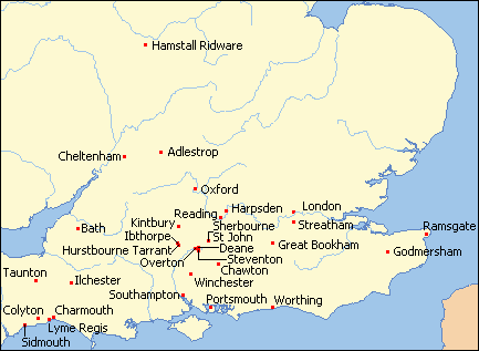
Jane_Austen_Map.png (433 × 317 pixel, iyeltakaldo : 13 kio, MIME ord : image/png)
Pimtara
| Pimtara | Map of Britain from Online Map Creation, colored and cropped by Ruhrfisch, red dots are the thirty places where Jane Austen lived or visited, added by Ruhrfisch |
| Evla | |
| Klita | Online Map Creation, (which uses GMT,[1] an open source software licensed under GNU GPL[2]) |
| Askisik | Online Map Creation, Ruhrfisch |
| Novera (Va bata ewava gin faver) |
GFDL |

|
Cette image (de type carte) devrait être recréée dans un format vectoriel, en tant que fichier SVG. Cela offrirait plusieurs avantages : voir Commons:Media for cleanup pour plus d'informations. Si une version SVG de cette image est déjà disponible, merci de bien vouloir l'envoyer. Après cela, remplacez ce modèle par {{vector version available|nouveau nom d'image.svg}}.
|
Sortara :
Moi, en tant que détenteur des droits d’auteur sur cette œuvre, je la publie sous la licence suivante :

|
Permission is granted to copy, distribute and/or modify this document under the terms of the GNU Free Documentation License, Version 1.2 or any later version published by the Free Software Foundation; with no Invariant Sections, no Front-Cover Texts, and no Back-Cover Texts. A copy of the license is included in the section entitled GNU Free Documentation License. |
| Bat iyeltak wetce Creative Commons Attribution-Share Alike 3.0 Unported zo sortayar. | ||
| ||
| Ce bandeau de licence a été ajouté à ce fichier dans le cadre de la procédure de mise à jour des licences des images sous GFDL. |
Iyeltakizvot
Witison va iyeltak inde in banugale awir, va evla/bartiv vulegal !!
| Evla/Bartiv | Aluk | Lumeem | Favesik | Sebuks | |
|---|---|---|---|---|---|
| ref | 8 bareaksat 2008 à 17:42 | | 433 × 317 (13 kio) | Ruhrfisch | Add labels to base map (as they did not show up consistently when wikilinked) |
| 7 bareaksat 2008 à 03:36 |  | 433 × 317 (10 kio) | Ruhrfisch | Update map to smaller version with dots to assist overlay placement, other info the same | |
| 11 toleaksat 2008 à 04:40 |  | 433 × 722 (28 kio) | Ruhrfisch | {{Information |Description= Map of Britain from [http://www.aquarius.geomar.de/cgi-bin/map-cgi.pl Online Map Creation], colored and cropped by Ruhrfisch |Date= December 2007 |Author= Online Map Creation, Ruhrfisch |Permission= GFDL |oth |
Favera va iyeltak
Valevefa bugluyaxa va bat iyeltak :
Jadifa iyeltakura
Valevefi wiki va bat iyeltak malsaved :
- Favera dene ar.wikipedia.org
- Favera dene bg.wikipedia.org
- Favera dene en.wikipedia.org
- Favera dene es.wikipedia.org
- Favera dene fr.wikipedia.org