Iyeltak:North America second level political division 2.svg

Xantaf iyeltak(SVG iyeltak, prekson 512 × 596 pixels, iyeltakaldo : 132 kio)

Bat iyeltak tir mal Wikimedia Commons ise gan yonar abdumimaks rotir zo faver. Pimtara moe inafu iyeltakbu valeveon zo nedir.

Pimtara

Pimtara
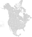
English: Map of North America and its second-level political divisions. Canadian provinces, US and Mexican states. Canada, Mexico, United States.

Non-contiguous parts of a states/provinces are "grouped" together with the main area of the state/provinces, so any state/provinces can be coloured in completion with one click anywhere on the state/provinces's area.

Also, all states/provinces have a "id" attached to them, making them easy to find. Select "find" and then enter in the state/provinces's ISO 3166-2 code in the "id" field to find it. The codes can be found here (Canada), here (USA) and here (Mexico).
Evla
Klita

Canada and US map: BlankMap-USA-states-Canada-provinces, HI closer.svg by Lokal_Profil.
Mexico map: Mexico template.svg by Mario Fuente Cid
Combined by Alex Covarrubias.

 
Le code de ce fichier SVG est valide.
 
Cette image vectorielle a été créée avec Inkscape, puis modifiée à la main
.
 
W3C-validity not checked.
Askisik Alex Covarrubias
Novera
(Va bata ewava gin faver)
w:fr:Creative Commons
gaara Milinde paká
Til nuyaf :
  • Ta walzilira – ta ksudara va kobara azu walzilira azu deara
  • Ta warzafa ponara – Ta zalera va grabom
Nope valevef kredeem :
  • gaara – Va folack govanzilil ise va gluyaxa godaful ise gobazel kase betara al zo skud. Laninde gonaskil voxe mekane gometiavel da gelfasik va rin ik rinafa favera vanovar.
  • Milinde paká – Ede va bat valdig betal ike artazukar ike voner, pune va nekis valdig wetce mila ok milafa sorta gu bat goxolel.
Autres versions

Derivative works of this file:

Légendes

Ajoutez en une ligne la description de ce que représente ce fichier

Éléments décrits dans ce fichier

dépeint français

7 saneaksat 2007

Iyeltakizvot

Witison va iyeltak inde in banugale awir, va evla/bartiv vulegal !!

Evla/BartivAlukLumeemFavesikSebuks
ref23 santaneaksat 2020 à 01:51Aluk va siatos ke 23 santaneaksat 2020 à 01:51512 × 596 (132 kio)Ponderosapine210Added the prominent islands of Manitoulin (Ontario) and Isle Royale (Michigan) to the Great Lakes.
1 teveaksat 2019 à 23:07Aluk va siatos ke 1 teveaksat 2019 à 23:07512 × 596 (130 kio)Fluffy89502added territories, made DC visible, adjusted mexican borders
4 balemeaksat 2014 à 12:23Aluk va siatos ke 4 balemeaksat 2014 à 12:231712 × 1992 (270 kio)Lommesmade the borders between the mexican subdivisions the same size as their canadian / us counterparts.
8 santoleaksat 2007 à 23:23Aluk va siatos ke 8 santoleaksat 2007 à 23:231712 × 1992 (327 kio)Lokal ProfilCode cleanup
7 saneaksat 2007 à 07:55Aluk va siatos ke 7 saneaksat 2007 à 07:551712 × 1992 (342 kio)AlexCovarrubias== Summary == {{Information |Description=Map of North America and its second-level political divisions. Canadian provinces, US and Mexican states. Canada, Mexico, United States. |Source=Canada and US map by Alan Rockefeller. Mexico map by Alex Covarrubias

Meku bu va bata ewava ruldar.

Jadifa iyeltakura

Veyorigeem