Iyeltak:Relief Map of Lithuania.jpg

Lum ke bata abdiwira : 800 × 600 px. Ar goraks: 320 × 240 px | 640 × 480 px | 1024 × 768 px | 1200 × 900 px.
Xantaf iyeltak (1200 × 900 pixel, iyeltakaldo : 387 kio, MIME ord : image/jpeg)
Pimtara
| Pimtara |
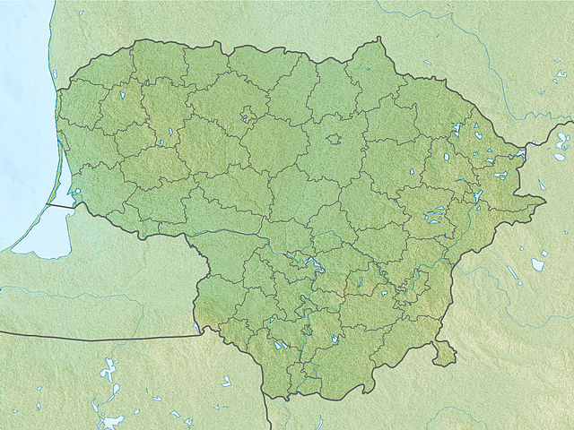
English: Location map of Lithuania Equirectangular projection, N/S stretching 170 %. Geographic limits of the map:
|
| Evla | (UTC) |
| Klita | |
| Askisik |
|
| Cette image a été retouchée, ce qui signifie qu'elle a été modifiée par ordinateur et est différente de l'image d'origine. L'image d'origine se trouve ici : Lithuania location map.svg:
|
Sortara :
Moi, en tant que détenteur des droits d’auteur sur cette œuvre, je la publie sous les licences suivantes :
Bat iyeltak wetce Creative Commons Attribution-Share Alike 3.0 Unported zo sortayar.
- Til nuyaf :
- Ta walzilira – ta ksudara va kobara azu walzilira azu deara
- Ta warzafa ponara – Ta zalera va grabom
- Nope valevef kredeem :
- gaara – Va folack govanzilil ise va gluyaxa godaful ise gobazel kase betara al zo skud. Laninde gonaskil voxe mekane gometiavel da gelfasik va rin ik rinafa favera vanovar.
- Milinde paká – Ede va bat valdig betal ike artazukar ike voner, pune va nekis valdig wetce mila ok milafa sorta gu bat goxolel.

|
Permission is granted to copy, distribute and/or modify this document under the terms of the GNU Free Documentation License, Version 1.2 or any later version published by the Free Software Foundation; with no Invariant Sections, no Front-Cover Texts, and no Back-Cover Texts. A copy of the license is included in the section entitled GNU Free Documentation License. |
Va solnarina sorta rorewal
Journal des téléversements d’origine
This image is a derivative work of the following images:
- File:Lithuania_location_map.svg licensed with Cc-by-sa-3.0, GFDL
- 2010-03-20T22:53:54Z NordNordWest 1095x821 (111884 Bytes) update
- 2008-08-29T08:11:36Z NordNordWest 1097x822 (103917 Bytes)
- 2008-07-02T15:27:16Z NordNordWest 548x411 (126294 Bytes) {{Information |Description= {{de|Positionskarte von [[:de:Litauen|Litauen]]}} Quadratische Plattkarte, N-S-Streckung 170 %. Geographische Begrenzung der Karte: * N: 56.7° N * S: 53.7° N * W: 20.4° O * O: 27.2° O {{en|Loca
Téléversé avec derivativeFX
Iyeltakizvot
Witison va iyeltak inde in banugale awir, va evla/bartiv vulegal !!
| Evla/Bartiv | Aluk | Lumeem | Favesik | Sebuks | |
|---|---|---|---|---|---|
| ref | 27 santaneaksat 2010 à 17:34 | | 1200 × 900 (387 kio) | Виктор В | {{Information |Description={{en|Location map of Lithuania}} Equirectangular projection, N/S stretching 170 %. Geographic limits of the map: * N: 56.7° N * S: 53.7° N * W: 20.4° E * E: 27.2° E |Source=*[[:File:Lithuania_location_m |
Favera va iyeltak
Meku bu va bata ewava ruldar.
Jadifa iyeltakura
Valevefi wiki va bat iyeltak malsaved :
- Favera dene als.wikipedia.org
- Favera dene an.wikipedia.org
- Favera dene ar.wikipedia.org
- Favera dene ast.wikipedia.org
- Favera dene azb.wikipedia.org
- Favera dene az.wikipedia.org
- Şablon:Yer xəritəsi Litva
- Aukştaytiya Milli Parkı
- Drukşyay gölü
- Platelyay gölü
- Klaypeda Dəmiryol Stansiyası
- Rusne adası
- İqnalina AES
- Kurş dili
- Vyante burnu
- Asveya gölü
- Çepkelyay
- Vilnüs Dəmiryolu Stansiyası
- Rambinas
- Labanoras Regional Parkı
- Tituvenay regional parkı
- Tauraqnas gölü
- Trakay Tarixi Milli Parkı
- Elektrenay su anbarı
- Favera dene ba.wikipedia.org
- Favera dene be.wikipedia.org
loa favera va bat iyeltak wil !!