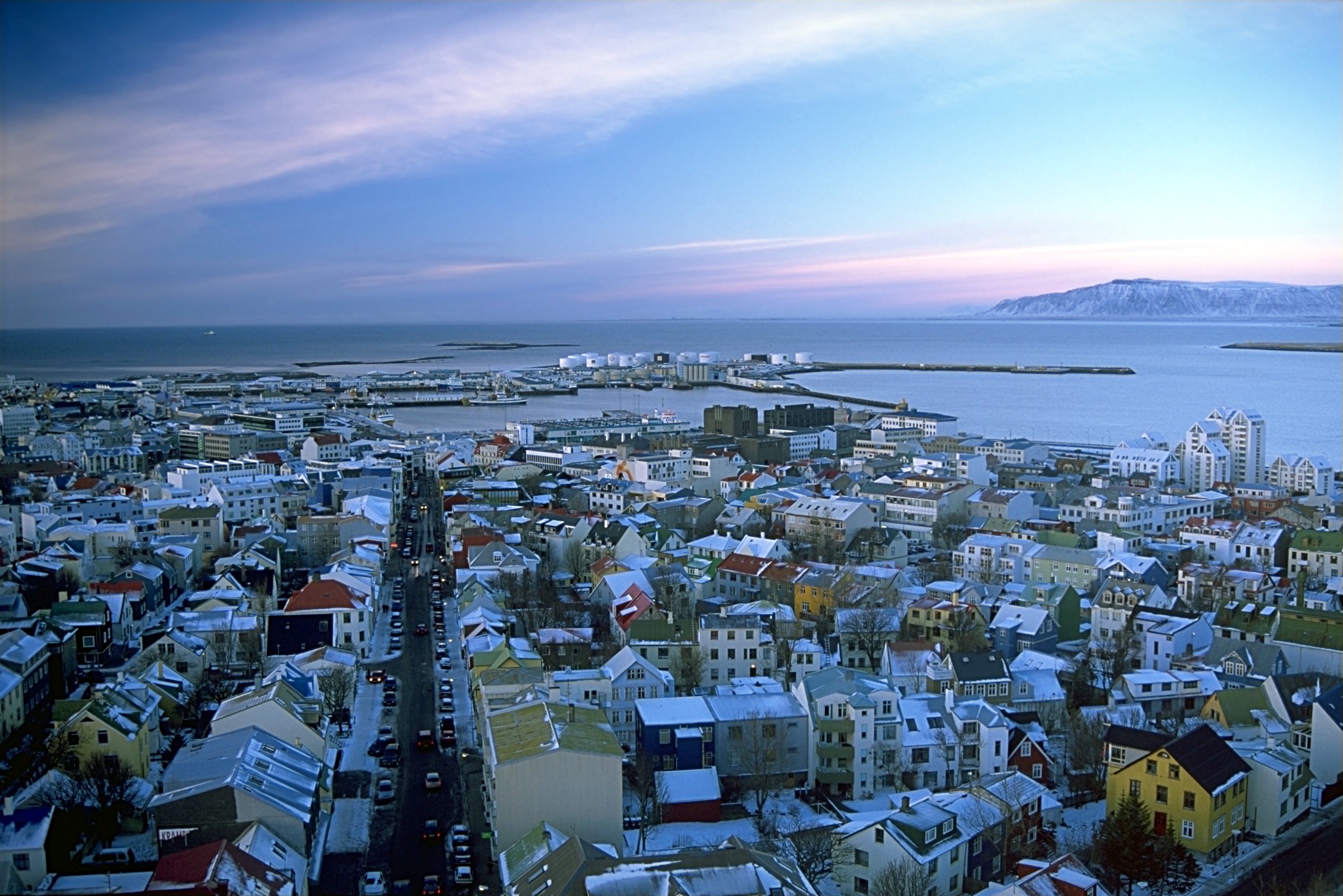
Iyeltak:Reykjavík séð úr Hallgrímskirkju.jpeg
Lum ke bata abdiwira : 800 × 534 px. Ar goraks: 320 × 214 px | 640 × 427 px | 1024 × 683 px | 1280 × 854 px | 2971 × 1983 px.
Xantaf iyeltak (2971 × 1983 pixel, iyeltakaldo : 859 kio, MIME ord : image/jpeg)
| Pimtara | |||
| Evla | |||
| Klita |
Pilkaf grabom - see http://fam-tille.de/sparetime.html |
||
| Askisik | Andreas Tille | ||
| Novera (Va bata ewava gin faver) |
Quote of http://fam-tille.de/island/winter/0204/2003_100.html - Permission is granted to copy, distribute and/or modify this images under the terms of the GNU Free Documentation License, Version 1.1 or any later version published by the Free Software Foundation. Moi, en tant que détenteur des droits d’auteur sur cette œuvre, je la publie sous les licences suivantes :
Ce fichier est sous licence Creative Commons Attribution – Partage dans les Mêmes Conditions 3.0 (non transposée), 2.5 Générique, 2.0 Générique et 1.0 Générique.
Va solnarina sorta rorewal |

| Lieu de la prise de vue | | Voir cet endroit et d’autres images sur : OpenStreetMap |
|---|
| Appareil photo | Minolta Dynax 7 |
|---|---|
| Objectif | 4/35-70 |
| Filtre(s) | none |
| Support | Manfrotto 190B |
| Pellicule | Kodak Elitechrome Extracolor |
Iyeltakizvot
Witison va iyeltak inde in banugale awir, va evla/bartiv vulegal !!
| Evla/Bartiv | Aluk | Lumeem | Favesik | Sebuks | |
|---|---|---|---|---|---|
| ref | 11 anyusteaksat 2005 à 05:49 | | 2971 × 1983 (859 kio) | Tillea | |
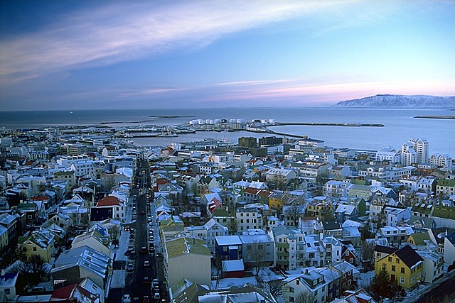
| 2 santoleaksat 2004 à 13:38 |  | 2963 × 1978 (2,9 Mio) | Ævar Arnfjörð Bjarmason |
Favera va iyeltak
Valevefa bugluyaxa va bat iyeltak :
Jadifa iyeltakura
Valevefi wiki va bat iyeltak malsaved :
- Favera dene af.wikipedia.org
- Favera dene an.wikipedia.org
- Favera dene ar.wikipedia.org
- Favera dene be-tarask.wikipedia.org
- Favera dene be.wikipedia.org
- Favera dene bn.wikipedia.org
- Favera dene br.wikipedia.org
- Favera dene ca.wikipedia.org
- Favera dene csb.wikipedia.org
- Favera dene cv.wikipedia.org
- Favera dene cy.wikipedia.org
- Favera dene da.wikipedia.org
- Favera dene de.wikipedia.org
- Favera dene de.wikibooks.org
- Favera dene dsb.wikipedia.org
- Favera dene en.wikipedia.org
- Favera dene en.wikibooks.org
- Favera dene es.wikipedia.org
- Favera dene eu.wikipedia.org
- Favera dene ext.wikipedia.org
- Favera dene fa.wikipedia.org
- Favera dene frr.wikipedia.org
- Favera dene fr.wikipedia.org
loa favera va bat iyeltak wil !!