Iyeltak:Rio Magdalena Delta landsat.jpg
Lum ke bata abdiwira : 653 × 599 px. Ar goraks: 262 × 240 px | 523 × 480 px | 837 × 768 px | 1096 × 1006 px.
Xantaf iyeltak (1096 × 1006 pixel, iyeltakaldo : 557 kio, MIME ord : image/jpeg)
Pimtara
| Pimtara |
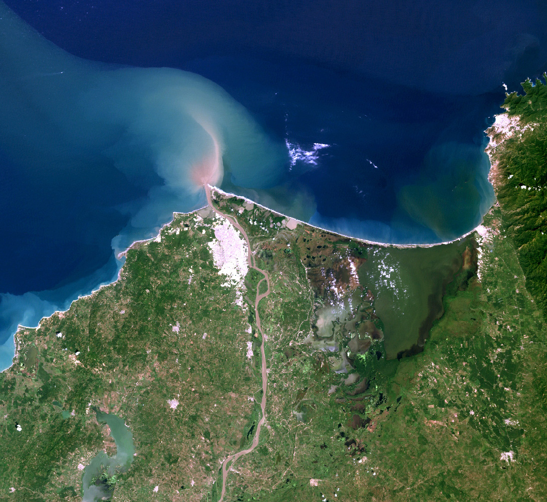
English: Landsat7 image of the Magdalena River delta. |
| Evla | |
| Klita |
Source for this data set was the Global Land Cover Facility, www.landcover.org
|
| Askisik | Alexrk2 |
| Novera (Va bata ewava gin faver) |
Use is free to all; effectively held by USGS & NASA; but ultimately held by US public. |
Sortara :
| Ce fichier provient de la NASA. Sauf exception, les documents créés par la NASA ne sont pas soumis à copyright. Pour plus d'informations, voir la politique de copyright de la NASA. | ||
 |
Attention :
|
Iyeltakizvot
Witison va iyeltak inde in banugale awir, va evla/bartiv vulegal !!
| Evla/Bartiv | Aluk | Lumeem | Favesik | Sebuks | |
|---|---|---|---|---|---|
| ref | 9 toleaksat 2010 à 16:14 | | 1096 × 1006 (557 kio) | Alexrk2 | {{Information |Description={{en|Landsat7 image of the Magdalena River delta.}} |Source=Source for this data set was the Global Land Cover Facility, www.landcover.org * Acquisition date: 2000-11-25, Sensor: ETM+, Bands: 1,2,3 |Date=2 |
Favera va iyeltak
Valevefa bugluyaxa va bat iyeltak :
Jadifa iyeltakura
Valevefi wiki va bat iyeltak malsaved :
- Favera dene af.wikipedia.org
- Favera dene ast.wikipedia.org
- Favera dene azb.wikipedia.org
- Favera dene bh.wikipedia.org
- Favera dene de.wikipedia.org
- Favera dene el.wikipedia.org
- Favera dene en.wikipedia.org
- Favera dene es.wikipedia.org
- Favera dene fa.wikipedia.org
- Favera dene fr.wikipedia.org
- Favera dene id.wikipedia.org
- Favera dene io.wikipedia.org
- Favera dene ja.wikipedia.org
- Favera dene ka.wikipedia.org
- Favera dene la.wikipedia.org
- Favera dene nl.wikipedia.org
- Favera dene nn.wikipedia.org
- Favera dene simple.wikipedia.org
- Favera dene sl.wikipedia.org
- Favera dene sw.wikipedia.org
- Favera dene ta.wikipedia.org
- Favera dene tr.wikipedia.org
- Favera dene vi.wikipedia.org
- Favera dene war.wikipedia.org
- Favera dene xmf.wikipedia.org