Iyeltak:Satellite photo of the area around Port-Gentil.png

Lum ke bata abdiwira : 800 × 507 px. Ar goraks: 320 × 203 px | 640 × 405 px | 1034 × 655 px.
Xantaf iyeltak (1034 × 655 pixel, iyeltakaldo : 388 kio, MIME ord : image/png)
Pimtara
| Pimtara |
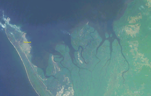
English: Satellite photo of the area around Port-Gentil |
| Evla | |
| Klita | Worldwind |
| Askisik | Nasa |
Sortara :
| Cette image est dans le domaine public car elle est constituée d'une capture d'écran du logiciel World Wind de la NASA qui utilise des données du domaine public, comme Blue Marble, MODIS, Landsat, SRTM, USGS ou GLOBE.
|
 |
Iyeltakizvot
Witison va iyeltak inde in banugale awir, va evla/bartiv vulegal !!
| Evla/Bartiv | Aluk | Lumeem | Favesik | Sebuks | |
|---|---|---|---|---|---|
| ref | 19 santoleaksat 2018 à 14:59 | | 1034 × 655 (388 kio) | Peter in s | {{Information |description ={{en|1=Satellite photo of the area around Port-Gentil}} |date =2018-12-19 |source =Worldwind |author =Nasa }} Category:Port-Gentil Category:Satellite pictures of Gabon |
Favera va iyeltak
Valevefa bugluyaxa va bat iyeltak :
Jadifa iyeltakura
Valevefi wiki va bat iyeltak malsaved :
- Favera dene es.wikipedia.org
- Favera dene fr.wikipedia.org
- Favera dene ru.wikipedia.org