Iyeltak:Uruguay location map Topographic.png

Lum ke bata abdiwira : 571 × 599 px. Ar goraks: 229 × 240 px | 457 × 480 px | 732 × 768 px | 976 × 1024 px | 2128 × 2233 px.
Xantaf iyeltak (2128 × 2233 pixel, iyeltakaldo : 6,19 Mio, MIME ord : image/png)
Pimtara
| Pimtara |
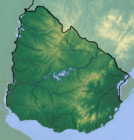
Deutsch: Positionskarte von Uruguay
Quadratische Plattkarte, Geographische Begrenzung der Karte:
English: Location map of Uruguay
Equirectangular projection, Geographic limits of the map:
|
| Evla | |
| Klita |
Pilkaf grabom
|
| Askisik | Dr Brains |
Sortara :
Moi, en tant que détenteur des droits d’auteur sur cette œuvre, je la publie sous la licence suivante :

|
Permission is granted to copy, distribute and/or modify this document under the terms of the GNU Free Documentation License, Version 1.2 or any later version published by the Free Software Foundation; with no Invariant Sections, no Front-Cover Texts, and no Back-Cover Texts. A copy of the license is included in the section entitled GNU Free Documentation License. |
Si ce fichier est admissible à une nouvelle licence, il peut également être utilisé dans le cadre de la licence Attribution - Partage dans les Mêmes Conditions 3.0 non transposé (CC BY-SA 3.0). Le statut de cette image doit être revu manuellement par un utilisateur expérimenté. Vous pouvez aider.
|
Iyeltakizvot
Witison va iyeltak inde in banugale awir, va evla/bartiv vulegal !!
| Evla/Bartiv | Aluk | Lumeem | Favesik | Sebuks | |
|---|---|---|---|---|---|
| ref | 9 teveaksat 2012 à 22:38 | | 2128 × 2233 (6,19 Mio) | Dr Brains |
Favera va iyeltak
Valevefa bugluyaxa va bat iyeltak :
Jadifa iyeltakura
Valevefi wiki va bat iyeltak malsaved :
- Favera dene azb.wikipedia.org
- Favera dene ca.wikipedia.org
- Favera dene ckb.wikipedia.org
- Favera dene en.wikipedia.org
- Favera dene fa.wikipedia.org
- Favera dene he.wikipedia.org
- Favera dene ja.wikipedia.org
- Favera dene ml.wikipedia.org
- Favera dene pa.wikipedia.org
- Favera dene shn.wikipedia.org
- Favera dene simple.wikipedia.org
- Favera dene si.wikipedia.org
- Favera dene th.wikipedia.org
- Favera dene uk.wikipedia.org
- Favera dene uz.wikipedia.org