Mijikenda tumtaf aalxoeem
|
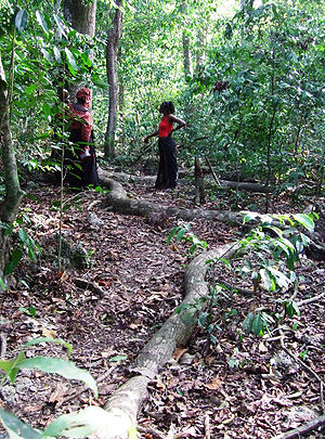
Mijikenda tumtaf aalxoeem ( englavon Sacred Mijikenda Kaya Forests ), tir burkaf debak ke Kenya. Mijikenda tumtaf aalxoeem tir tano katcalapafo izvaxo ke tawava nume bak 2008 wetce arayaf debak ke tamavafa gadakiewega ke UNESCO zo bendeyer.
 Tumtafo kaya aalxo ke Mijikenda sane nited san-tanoy solwif aalaf debak kene krimta vas mon 200 km-. Tid dem stabrega ke jontika folkaykirafa kaya wida ke Mijikenda sane. Bata wida reduyuna mali XVI-eafa decemda bak 1940-e sanda zo jovleyed. Gu ambafa oga re zo torigid nume gu tumtaxo zo gided ise gan savsikaf pirdot zo kiewagid. Debak gu tanafa vrutara va arayafa prostewa is nope inyona rontifa gluya tikisa va blisa prostewa zo bender. ~ UNESCO : Tumtafo aalxo ke Mijikenda (en) The Mijikenda Kaya Forests consist of 11 separate forest sites spread over some 200 km along the coast containing the remains of numerous fortified villages, known as kayas, of the Mijikenda people. The kayas, created as of the 16th century but abandoned by the 1940s, are now regarded as the abodes of ancestors and are revered as sacred sites and, as such, are maintained as by councils of elders. The site is inscribed as bearing unique testimony to a cultural tradition and for its direct link to a living tradition. ~ UNESCO website, licence CC-BY-SA IGO 3.0
Vexala dem bendeyeno kaya aalxobetaraEwava va debakbetara
Vuestexabetara
|
| ||||||||||||||||||||||||||||||||||||||||

